Category Archives: Linked Open Data

Australian Cultural Data Futures

Australian Cultural Data Futures — Australian Cultural Data Engine

Free event at the University of Melbourne next Thursday, yes I will be there! Australian Cultural Data Futures, Thursday, 24 August 2023, 9:00 am to 4:30 pm, University of Melbourne.

I will talk about 360 panoramas and 3D, the article from this research is available online via the Heritage Journal or via an online encyclopedia

Cultural data collections in Australia are at a critical juncture. While exciting new methods and approaches in cultural analytics have revealed the multifaceted uses and cross-disciplinary value of…

·

1 View

New Journal article

Our article “Exploring Historical Australian Expeditions with Time-Layered Cultural Maps” has been published in IJGI and is available online:

Website: https://www.mdpi.com/2220-9964/12/3/104
PDF Version: https://www.mdpi.com/2220-9964/12/3/104/pdf

Exploring Historical Australian Expeditions with Time-Layered Cultural Maps

The Australian Time Layered Cultural Map platform was created to help digital humanities scholars investigate how online geospatial tools could provide exemplars to their humanities colleagues on how historical collections and cultural data could be extended and re-examined with geospatial tools. The project discussed here investigated how Recogito/TMT could effectively extract spatial and temporal data from pure text-based historical information and generate time-layered interactive maps of that spatio-temporal data using accessible and user-friendly software. The target audience was humanities scholars relatively new to geospatial technologies and relevant programming systems. The interactive maps were created with two free, open-source web applications and one commercial GIS (Geographic Information System) mapping application. The relative pros and cons of each application are discussed. This paper also investigates simple workflows for extracting spatiotemporal data into RDF (Resource Description Framework) format to be used as Linked Open Data.

3D, Maps and DBPedia

The UNESCO Chair of Cultural Heritage and Visualisation (10/2016 – 09/2020) project at https://unesco-chv.curtin.edu.au will be shut down in June 2022.

Before then feel free to look at the online Australian map platform with 3D models, Linked Open Data, DBpedia, open data etc… https://unesco-chv.curtin.edu.au/mapplatform but please allow 20-30 seconds for some of the larger 3D models to load.

It was developed for Ikrom Nishanbaev’s PhD project, (supervised with Dr David McMeekin), the thesis by publication has just been successfully reviewed.

Thank you to Ikrom, David, the GIS and cultural heritage people who provided feedback and the reviewers.

Interesting to note Ikrom started the PhD in humanities then when I left Curtin University he moved to Science and Engineering. So it is arguably a truly interdisciplinary Digital Humanities project.

One of his papers received an award. The papers are listed at:

Australian Cultural Data Engine-2 year LIEF

Just been given the green light to be officially on the following #ARC #LIEF grant: “Australian Cultural Data Engine for Research, Industry and Government” (announced in December but took this long):

“…Australian Cultural Data Engine for Research, Industry and Government. The project aims to develop an Australian Cultural Data Engine (ACD-Engine), which will be an open software engineering facility that interacts with leading existing cultural databases in architecture, visual and performing arts, humanities, and heritage to build a bridge to information and social sciences. The ACD-Engine will unify and expand these disparate and previously unconnected systems to allow advanced analysis techniques to be performed. It will deliver innovative and searchable formats that ensure interoperability, improved search, interactive design and interpretation aids that will benefit the policy and planning for national and international alignments between researchers, industry and government.”

This will be my fourth Australian Research Council grant (Chief Investigator)* since 2018. The University of Melbourne leads this grant, it runs for two years.

*Also an expert advisor on 5-year ARC Indigenous Discovery grant.

Metadata in 3D file formats

Something to explore at a later date but it seems X3D and Collada are recommended when placing metadata (like exif) in a 3D file.

6 month Research Assistant position

I require a research assistant for an ARC LIEF project:

Fixed Term Research Assistant for Time Layered Culture Map Project (Web-based Mapping and AR/MR/VR technologies] 

  • Develop exemplars of cultural heritage data integrated with GIS data, on open source web platform Recogito [https://recogito.pelagios.org/] or equivalent.
  • Advise and develop related semantic web ontologies, features and supporting data.
  • Develop working examples of cultural heritage sites on this platform along with requested visualisation and annotation features (requested by supervisor)
  • Help integration with envisaged virtual reality, augmented reality and mixed reality platforms and related devices
  • Assist development of reports, tutorials, scholarly publications and grant applications based on the above including sourcing earlier papers and case studies
  • Store all examples and codes on accessible software repositories as requested by supervisor
  • Demonstrate, where required, the above GIS, mapping and semantic web examples.
  • Expertise required: knowledge of GIS, GeoJSON or similar, programming, familiarity with recent AR/VR technologies would be an advantage.
  • SALARY: G05.3  level.
  • The work is based at Curtin and can be shared but covers 6 months fulltime worl starting ASAP.

The job will be advertised soon but please contact erik dot champion at curtin edu au for any questions.

3D and GIS

Today Ikrom had his milestone presentation and (it was the first for me at Curtin so training wheels) but the reviewer questions were more,..ok can you do this for this project of mine..which actually is great..

A Survey of Geospatial Semantic Web for Cultural Heritage

Ikrom showed his project development to build a  web-based 3D landscape or building model viewer with GIS and Semantic Web/RDF compatibility using open source technology. It is basically the starting demo for the paper released, open source, at:

So, cultural heritage people, what would you want to do with 3D online models with LOD, Semantic Web technology, and the ability to question, select or annotate the 3D online model using say a drawing tablet pen or lassoo or…what questions would you want to be able to ask it or what parts or argument would you want to be able to show?

New Journal Article on Geospatial Semantic Web

The amount of digital cultural heritage data produced by cultural heritage institutions is growing rapidly. Digital cultural heritage repositories have therefore become an efficient and effective way to disseminate and exploit digital cultural heritage data. However, many digital cultural heritage repositories worldwide share technical challenges such as data integration and interoperability among national and regional digital cultural heritage repositories. The result is dispersed and poorly-linked cultured heritage data, backed by non-standardized search interfaces, which thwart users’ attempts to contextualize information from distributed repositories. A recently introduced geospatial semantic web is being adopted by a great many new and existing digital cultural heritage repositories to overcome these challenges. However, no one has yet conducted a conceptual survey of the geospatial semantic web concepts for a cultural heritage audience. A conceptual survey of these concepts pertinent to the cultural heritage field is, therefore, needed. Such a survey equips cultural heritage professionals and practitioners with an overview of all the necessary tools, and free and open source semantic web and geospatial semantic web platforms that can be used to implement geospatial semantic web-based cultural heritage repositories. Hence, this article surveys the state-of-the-art geospatial semantic web concepts, which are pertinent to the cultural heritage field. It then proposes a framework to turn geospatial cultural heritage data into machine-readable and processable resource description framework (RDF) data to use in the geospatial semantic web, with a case study to demonstrate its applicability. Furthermore, it outlines key free and open source semantic web and geospatial semantic platforms for cultural heritage institutions. In addition, it examines leading cultural heritage projects employing the geospatial semantic web. Finally, the article discusses attributes of the geospatial semantic web that require more attention, that can result in generating new ideas and research questions for both the geospatial semantic web and cultural heritage fields.

Living Labs

I am not sure why but I have been asked to attend a potential university Living Labs meeting tomorrow.

  • What would a living lab for digital humanities look like?
  • What sort of facilities would help?
  • What type of environment would aid creativity and cope with dynamic researcher and visitor flows?

I think of not just architecture offices and theatres but also the Curtin Library Makerspace, the HIVE, the lecture rooms and computer labs and airport-lounge the Library is mutating into and think…

  1. The really creative lab spaces you want to make your own and there are unique spaces but the boundaries overflow into other spaces and other disciplines (I am thinking of Umeå’s digital humanities lab I visited in 2012 or 2013).
  2. They have views (visionary or otherwise) and perches and breakout spaces.
  3. There are PCs and whiteboards but also spaces to spread out prototypes to work in small groups…
  4. Plants.
  5. The transition between seated and standing space is gradual.
  6. Spaces to play music (I mean play).
  7. Design and test spaces can turn quickly into test and perform and critique spaces.
  8. You can walk around tables and other workspaces.
  9. It can be completely dark or gradually so.
  10. The screens (if any) are merged thematically into their surrounds or completely separated and portable/reconfigurable.
  11. There is one thematic oooh wow space that can be hidden/partitioned out of the way.
  12. Foot traffic does not have to interrupt the workers.
  13. There is a big big door to bring in and take out “stuff”.

I recall how inspired I was visiting the Aalto’s home and office in Munkkiniemi Helsinki, and also their living lab/cottage, experimental house, in Muuratsalo, (which you can visit in an Unreal game engine mod, if only I can find it again).

Actually, this meeting will no doubt be about equipment and power sources and data servers. And I’d have quite a bit to say on how I would have changed / extended our current lab.

But I can dream, Mr Aalto, upon your drawing table in the photo above, I can dream!

(And no, a Living Lab is not to be confused with a Library Lab. Or should it?)


Free workshop: Linked Open Data Workshop: from Books to HoloLens

HafizSusan.png

This workshop, an introduction to Linked Open Data, will have two presenters:

1 Enriching Historical Narratives with Structured Data 2-4PM

Historians create linked open data all the time, they just don’t know it. Much of their research is focused on documenting the relationships between people, places, events, and sources. But these rich data structures are squeezed out of publications. The LODBooks project is an attempt to put the data back into historical narratives.

Presented by Associate Professor Tim Sherratt, University of Canberra.

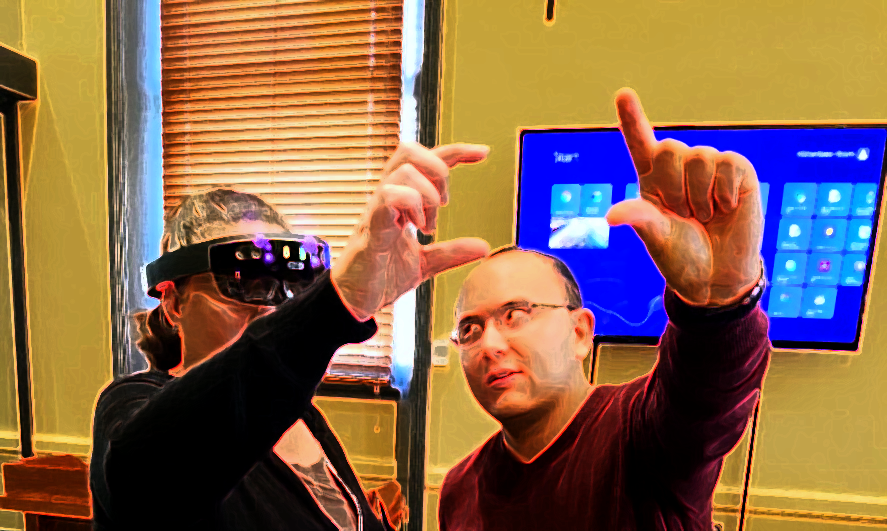
2 Linked Open Data on the HoloLens 4-5PM

Bring your own geolocational data or use the data provided to see how geodata can be used in the Microsoft HoloLens.

Presented by PhD candidate, Mafkereseb Bekele, Curtin University.

Complimentary tea and coffee will be provided during the workshop, thanks to the generous support of Curtin University Library. Associate Professor Tim Sherratt is here thanks to the generous support of a Pelagios working group grant that is funding the 27 July Symposium “Landscape Data Art & Models as Linked Open Data” in the HIVE.

Eventbrite URL here.

Landscape Data Art & Models as Linked Open Data

A free event on Linked Open Data and related Digital Humanities Projects will be taking place on 27 July.

Landscape Data Art & Models as Linked Open Data

The HIVE, (inside John Curtin Gallery) | Building 200A, Curtin University | Kent Street, Bentley | Perth, WA 6102 | Australia

Friday, 27 July 2018 from 10:00 am to 5:00 pm (Australian Western Standard Time)

Venue: The HIVE (inside John Curtin Gallery), Curtin University

Speakers (alphabetical order, program later), with provisional title and topic

Please note, if you do not know what RDF (Resource Description Framework), Semantic Web, or Linked Open Data is, we will have an intro workshop on this (and current Digital Humanities projects including Virtual Reality) in the Curtin Library Makerspace, Level 5, 3-4:30PM 26 July 2018. The working title is Linked Reality, Mixed Reality but a link to the free workshop will be provided from this page.